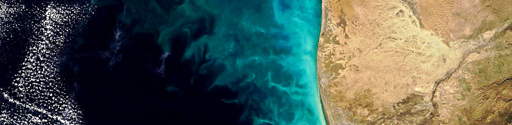
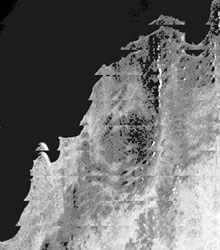
 The Bow-Tie effect is an artifact of the arrangement of sensors on the MODIS instrument. This results from the fact that MODIS scans 10 lines at a time. The pixel size on the ground increases with distance from the satellite. This satellite-to-ground distance increases with scan angle, mainly due to earth curvature. This means that the pixels near the edge of an image are bigger than the ones in the middle. The satellite is configured to move forward 10km in the time that it takes to perform one scan. This is so that pixels in the middle of the scan line match up next to each other. However, at the edges the pixels are bigger, up to 6 times wider and 4 times longer. This causes over-sampling, i.e., the same bit is imaged twice. As a result, the image seems distorted near the edges. The bow tie is a purely geometric effect. We do not "correct" for it in the Level 1B data. However, some downstream products (Level 2 or higher) may provide a correction for the bow tie effect. The effect should really be removed after all scientific processing of the data has been completed, i.e., after atmospheric correction and product generation. This lets the user know the appropriate look angle and solar angle for each pixel. An acceptable solution is to use a reprojection. The reprojection takes the geolocation product and uses it to produce a image with a standard projection. The reprojected image is free from the bow tie artifacts, the MODIS quicklooks are an example of this. The problem with this is that you aren’t able to calculate solar and zenith angles easily.